12 Gorgeous Hiking Trails In San Antonio, Texas
If you’re looking for some new hiking trails in San Antonio, Texas, you’ve come to the right place. Whether you find yourself wanting to explore new places in your hometown or if you’re just in town for the weekend, there are so many beautiful hiking trails to discover in San Antonio.
With 12 amazing trails on this list to discover, there’s something for everybody. So get your hiking boots ready and prepare to take in all the natural beauty, wildlife, and scenery that San Antonio hiking trails have to offer!
Quick Links
Best Hiking Trails In San Antonio, Texas
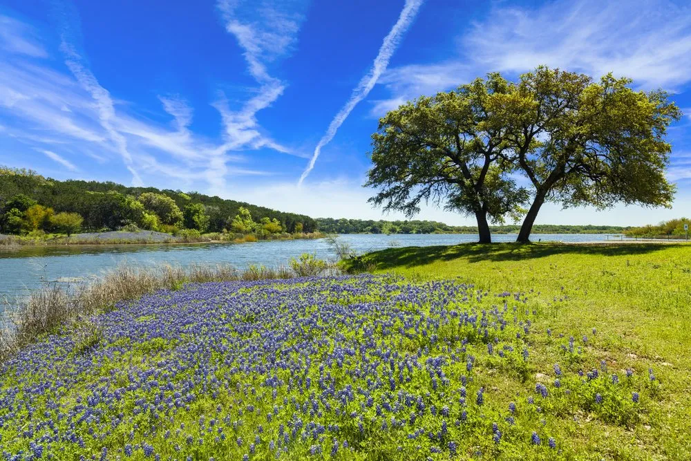
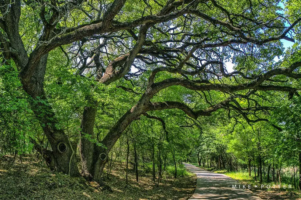
Rio Medina Trail
We’re starting our list with one of the most popular hiking trails in all of the San Antonio area. Rio Medina Trail is an out & back style trail that spans about 14 miles from end to end. It’s considered a pretty easy hike, perfect for everybody of all skill levels.
This trail is especially wonderful for moms with strollers and those who use a wheelchair. Unfortunately, dogs are not allowed on this trail, so your fur baby will have to stay at home for this hike. Rio Medina trail is located about 20 minutes from Downtown San Antonio and is a beautiful trail perfect for all sorts of outdoor activities, from hiking to roller skating.
This trail attracts many people who are looking to get away from the hustle and bustle of the downtown scene. There’s so much natural wonder to take in on this trail, including a gorgeous view of Rio Medina Lake, stretches of shady trees to cool yourself under, and beautiful washes of flowers to admire. And while you take in all this natural scenery, you may come across several historical sites along the way that can give you some insight into the local area.
- Length in Miles: 14.0
- Elevation Gain: 459
- Difficulty: Easy
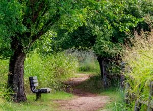
Wilderness and Wildlife Trails
These networks of trails are located only 10 minutes from Midtown San Antonio. These trails are perfect for those who want to get outside but don’t want to have to travel too far out of the city limits to get their hike on. The main trail, which is located at the mouth of Brackenridge Park is paved, but there are so many trails available that you can create and customize your unique hiking route every time you visit. There is plenty of nature to observe on the trail, with beautiful sweeping greenery and streams along the way.
The trail is considered to be very easy and is perfect for those with physical disabilities. The trail is often visited by students of Trinity university, which is located not too far away. After your hike, consider taking a trip to the local Witte museum. Here you can discover more about the history of Texas, dating from prehistoric times to the present day. There’s even the San Antonio aquarium to explore in the surrounding area. With an amazing hiking trail to explore and so much more to do in the surrounding area, rest assured that your day will be filled with fun and adventure!
- Length in Miles: 1.4
- Elevation Gain: 22
- Difficulty: Easy
Prairie, Painted Bunting, Barred Owl, and Live Oak Trails Loop
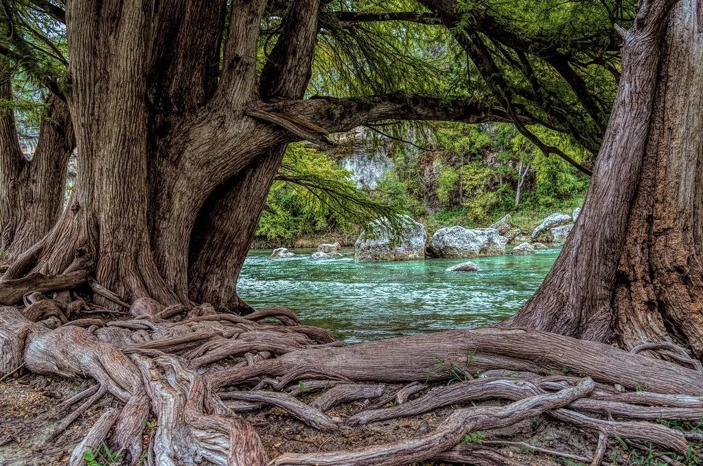
Located about 40 minutes outside of Midtown San Antonio, there are plenty of people who love to make this journey beyond the city limits on the weekends. Located in Spring Branch, Texas, in Guadalupe River State Park, this loop-style trail is a combination of several trails within the park. Most of the scenery on this hike is a lovely flat country that takes you through several open fields and oak stands.
The relative flatness of this trail makes it perfect for people of any skill level. The entire trail spans about 5 miles and will take you about 2 hours to complete from start to finish. The Guadalupe River State Park is an extremely popular area for hiking, mountain biking, and even horseback riding! So not only will you come across other people along the way, you may even see a couple of horses too!
There’s also lots of local wildlife to observe, and it’s not uncommon to see deer, hawks, armadillos, lizards, and snakes. This hike is completely flat but does tend to have some sticky parts along the trail. Be sure to watch your step in certain areas as there are many loose rocks you could potentially sprain an ankle on.
- Length in Miles: 5.1
- Elevation Gain: 236
- Difficulty: EasyModerate
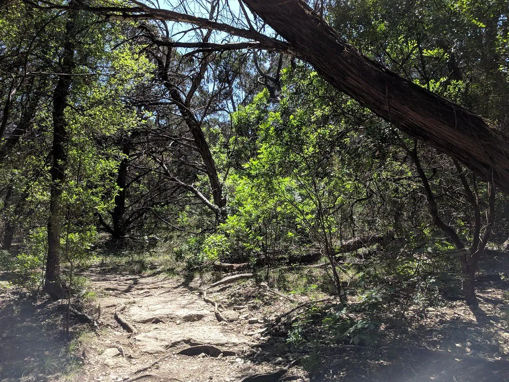
Bandera Creek Trail
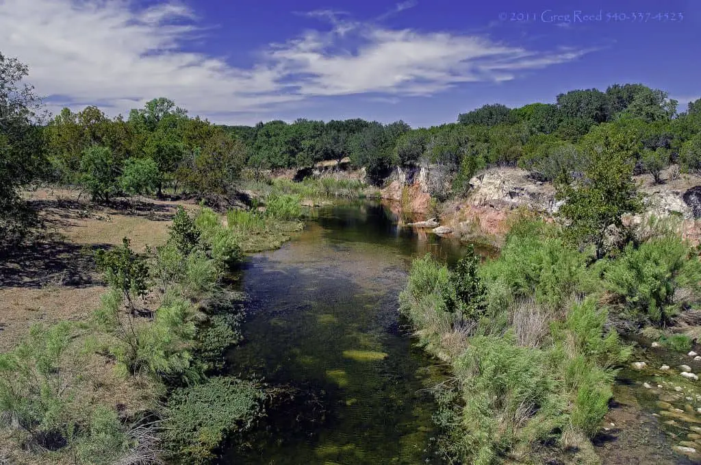
Located about an hour outside of the San Antonio City Limits, the Hill Country State Natural Area has approximately 40 miles of trails to offer. There is a $6 entrance fee into the Hill Country State Natural Area, but children 12 and under can enter for free.
The trails in this area are multi-use, so don’t be surprised if you come across people on horseback or mountain bikes! If you’re looking for a trail within this natural area that’s exclusively for hikers, then look no further than Bandera Creek Trail.
This rocky loop rail is just over 3 miles and is located dead smack in the middle of the park. This trail is considered to be fairly challenging, so make sure you have the proper shoes to take it on. Also, make sure to pack plenty of water because there are absolutely no water stations available on the trail.
And if you want to take it up a notch and make your hike even more of a challenge, consider taking the steep climb up West Peak Overlook, which has an unbeatable and rewarding view of the Hill Country area.
- Length in Miles: 2.77
- Elevation Gain: 144
- Difficulty: Easy
San Antonio River Walk Mission Reach Trail
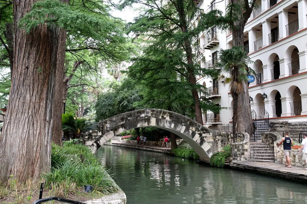
Located right in the middle of the hustle and bustle of San Antonio, the River Walk Mission Reach Trail is not only peaceful but a shining example of the efforts of urban ecosystem restoration. This nearly 6-mile trail is perfect for hikers of any level and will typically take an average of 2 hours to complete. In addition to hiking, the area is also excellent for camping, fishing, and bird watching. The trail is open 365 days a year and is beautiful all year round. Dogs are welcome and are allowed to be off-leash in designated areas.
While you explore this almost 6-mile trail, you might find yourself running into a local River Authority team member. These people are a part of a dedicated team that helps maintain the surrounding area free of trash and helps nurture native Texas greenery that provides essential seeds, pollen, fruit, and nectar for local wildlife.
- Length in Miles: 5.7
- Elevation Gain: 141
- Difficulty: Easy
Hillview Nature Trail Loop
Make sure to tie your hiking boots up properly for this short but rock trail! Hillview Nature Trail look is located in the northwestern part of the San Antonio area within Eisenhower park and is often flooded with heavy traffic because of how popular it is. Your best bet if you wanna beat the traffic is to get up early enough to catch the sunrise. This loop trail is just 3 miles, but that doesn’t mean that there isn’t much to see!
If you take the 1 ½ hours it takes to complete the trail, you’ll be immersed in a trail that is of raw nature. Some parts of the trail are your standard dusty road, while other parts require a little more precision because of the several rocky uphill sections. Because of this, the trail is categorized as a moderate trail. But don’t fret if this freaks you out a bit; there are paved sections that are excellent for those with disabilities or those who want a less intense hike.
If you get too overwhelmed by the trail, there are several rest stops with benches along the way. Dogs are welcome, but they must be kept on a leash at all times and picked up after. There are several poop bag stations throughout the trail as well.
- Length in Miles: 2.9
- Elevation Gain: 282
- Difficulty: Easy
McAllister Park Blue Loop Trail
Located in Uptown San Antonio, this soil trail is extremely popular for hiking, bird watching, and biking. The Blue Loop Trail, which is located in the huge 976-acre McAllister Park, makes a 6 ½ mile loop around the park which will take you about 2 ½ hours to complete all the way through. The trail is frequented by a variety of wildlife, so be prepared to see some deers, snakes, and armadillos!
The one thing about this trail is that there are no clear markers to tell you that you’re on the Blue Loop Trail or tell you how deep you are into the trail. So, if you’re really into not taking out your phone to check where you are, consider taking another trail. But, if you’re down to get a little lost in a beautiful, sprawling park, then this is perfect. If you have the time and the energy along your hike on the Blue Loop, consider stopping by the Soccer and Baseball fields along the way to catch a game or play in one!
- Length in Miles: 6.3
- Elevation Gain: 266
- Difficulty: Moderate
Library and Comanche Loops Trail
This quaint 1.6-mile loop trail is located in the Northeastern part of San Antonio near Universal City within the Comanche Lookout. This trail should only take you about 40 minutes to complete and is perfect for everybody of all skill levels. Not only does this trail offer scenic views of the city and beautiful wildlife, but it also offers several art installations and historical sites to see along the way.
This trail is extremely for hiking, bird watching, and trail running, so be sure to greet your fellow hikers while taking your time to explore the scene. The trail is throughout the year and is beautiful to visit during any time of the season You can bring your dog along with you on this trail, but they must be kept on a leash the entire time.
- Length in Miles: 1.6
- Elevation Gain: 114
- Difficulty: Easy
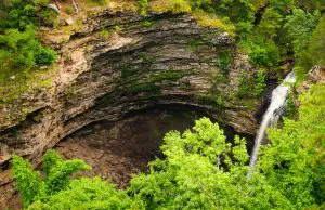
Lost Maples State Natural Area
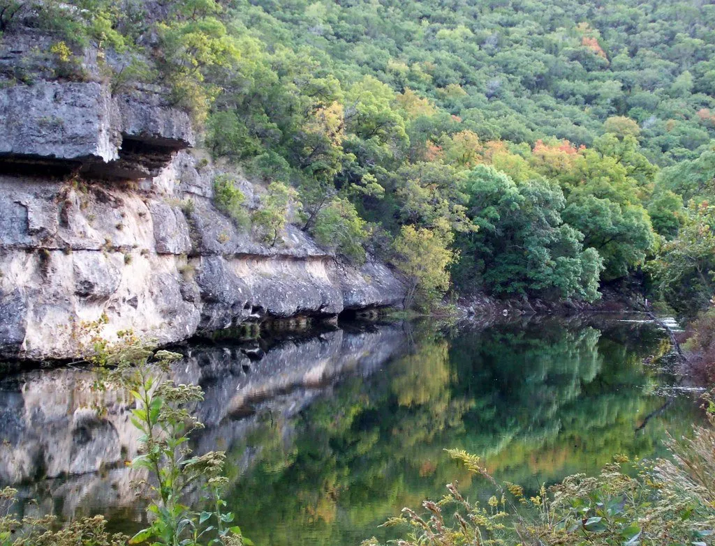
If you’re looking for a nice hiking weekend getaway from the San Antonio area, then Lost Maples State Natural Area is the perfect place to go. Located about 2 hours outside of San Antonio, this beautiful nature area is filled with maple trees that blaze beautiful reds and oranges in the Autumn season. This makes this area particularly special, as this change in greenery typically doesn’t happen in other parts of San Antonio.
With stunning rock formations paving the two trails on the east and western parts of the reserve, this trail is considered to be a moderately challenging hike. Visitors are highly encouraged to wear proper hiking boots for this adventure. This trail may be out of the way for some people, but the large canyons and lakes that you’ll be able to see on this weekend adventure are totally worth the trip.
Each trail at the Lost Maples State Natural Area is about 7 miles long and will take you, on average, about 3 hours to complete. Dogs are totally welcome to come along for the trip and are allowed to be off-leash in some designated areas.
- Length in Miles: 6.0-8.0
- Elevation Gain: 550-839
- Difficulty: Moderate
Leon Creek Greenway
This trail is located about 20 minutes from downtown San Antonio and is a part of The Howard W. Peak Greenway Trail System. This unique and growing network of trails offers approximately 82 miles of developed multi-use and accessible trails open from sunrise to sunset.
The Leon Creek trails are by far the most popular, offering 25 miles of paved multi-use trails and park connections. Those who visit Leon Creek will have the unique trail and will have the opportunity to take in incredible views of the area’s limestone bluffs, wildflower fields, washes of Cottonwoods, and trees that have stood for generations.
The main Leon Creek Greenway spans 12 miles and will take you about 4 ½ hours to complete from end to end. You’ll be able to immerse yourself in the peacefulness of nature while taking in all the greenery and bodies of water you’ll come across. You can bring a furry friend to keep you company on the trail, but they must be on a leash at all times.
- Length in Miles: 12.3
- Elevation Gain: 196
- Difficulty: Easy
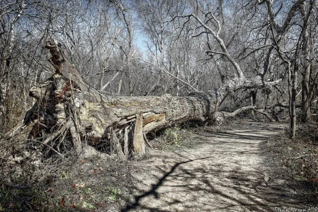
Main Loop to Restoration Way Trail
Located in the Northwestern park of San Antonio within the Friedrich Wilderness Park, this trail is an intermediate trail with unbeatable greenery and washes of shade to keep you cool during the warmer months. Friedrich Wilderness Park is home to approximately 10 miles of hiking trails that range in difficulty. The most popular trail to take in this park by far would be the.
This is a 5 ½ mile loop-style trail that is extremely popular for hiking, bird watching, and mountain biking. If you want to get the absolute most out of this trail, you should visit between April and September when the greenery is in full bloom, and the weather is to die for.
The greater Friedrich Wilderness Park is home to rare birds, including the endangered Black-capped Vireo and the Golden-cheeked Warbler. Visitors are highly encouraged to bring plenty of water for the hike, as there are very water stations once you’re deep into the trail.
- Length in Miles: 5.5
- Elevation Gain: 715
- Difficulty: Moderate
Inks Lake State Park Trail
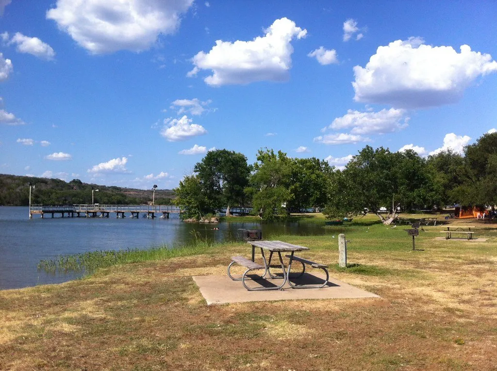
This final trail on our list is the perfect place for you if you like to fish just as much as you like to hike. This park is also a bit way outside of the city limits, taking about 2 hours due north of San Antonio to get there. The trip is worth it, we promise! Just getting there in and of itself is an adventure, so make sure to plan accordingly if you’re gonna make the trip.
The Inks Lake State Park is a sprawling area of land that surrounds the beautiful Colorado River. Inks Lake State Park offers about 7 ½ miles of hiking trails, including a 5-mile loop that is very popular among visitors. With a variety of trails ranging from wide, smooth roads to narrow, rocky passages, there’s a trail for hikers of all skill levels in this park.
This is the perfect place to be if you’re looking for some solitude during the quiet parts of the day. The scenic views offered at this park are quite a sight to see, but the trail doesn’t have as much shade as the other trails mentioned. With that being said, make sure to pack sunscreen, sunglasses, and a hat to enjoy your hike as comfortably and safely as possible.
- Length in Miles: 4.7
- Elevation Gain: 370
- Difficulty: Moderate
Frequently Asked Questions About Hiking In San Antonio, Texas
Are there mountains in San Antonio, Texas?
No, there are no mountains in San Antonio, Texas. However, there are plenty of hills and cliffs located throughout the city and its outskirts that make for great hiking spots. The closest mountain range to San Antonio is actually the Davis Mountains, which are about 3 hours away from the city.
What is the best time of year to go hiking in San Antonio?
The best time of year to go hiking in San Antonio is during the spring and fall months. The weather is usually mild during these times, making it more comfortable to hike for longer periods of time. Plus, the scenery is beautiful with all of the flowers blooming in the spring and the leaves changing color in the fall.
If you plan on going hiking in the summer, be sure to start early in the morning or late in the evening to avoid the heat of the day. San Antonio is one of the hottest cities in the country, so it’s essential to take the necessary precautions to stay safe and cool while hiking.
What should I bring with me while hiking in San Antonio?
There are a few essentials that you should always bring with you on a hike, regardless of where you are hiking or for how long. These include water, snacks, a map of the area, sunscreen, and a first-aid kit. You may also want to bring a camera to snap some pictures of the beautiful scenery.
How many trails are in San Antonio?
There are more than 140 trails located within the confines of San Antonio. However, there are also many trails located throughout the surrounding areas, including the Hill Country and Davis Mountains. So, whether you’re looking for an easy stroll or a challenging hike, you’re sure to find a perfect trail. If you’re looking for more than just hiking, discover the best state parks in Texas.
Is San Antonio above sea level?
San Antonio is located at an elevation of about 650 feet above sea level. However, since the city is located in the Hill Country, there are many areas that are much higher in elevation.