The 11 Best Hiking Trails In Arkansas (2023)
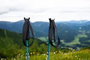
Welcome to the beauty of Arkansas – where the trails are endless, the views are breathtaking, and the hiking experience is unforgettable. With over 300 miles of hiking trails and plenty of awesome state parks, you’re sure to find something to suit your style, whether you prefer a challenging terrain or a leisurely stroll.
The state’s natural landscape boasts an abundance of mountains, forests, waterfalls, and rivers, making it a hiker’s dream destination. With temperatures ranging from 40-60 degrees in the winter and 80-90 degrees in the summer and fall, it’s the perfect place to venture outdoors all year round.
So pack your bags, lace up your boots, and get ready to experience Arkansas’s incredible trails firsthand. Let’s dive into some of the most popular hiking destinations in the state.
Quick Links
Whitaker Point Trail
This 2.9-mile out-and-back trail boasts breathtaking views and enchanting waterfalls. Start your journey at the trailhead off of County Road 5 – if the parking lot is full, be prepared to park along the road. The well-marked trail features a white sign at the entrance and takes about 2 hours to traverse. Keep an eye out for small waterfalls along the way.
Once you reach the Hawksbill Crag, you’ll be rewarded with stunning views of Whitaker Creek and a vast valley – perfect for a photo op with your furry friend! Speaking of which, leashed dogs are welcome on the trail.
- Length: 2.9 miles
- Elevation gain: 413 ft
- Difficulty: Moderate
- Pets Allowed: Yes, but must be on a leash.
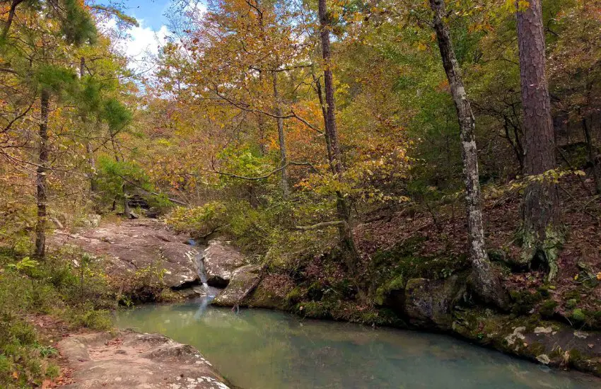
Lost Valley Trail
The Lost Valley Trail near Ponca, Arkansas offers stunning views and unique experiences. With a length of 2.3 miles and an elevation gain of 252 ft, this moderately challenging trail features natural bridges, rock formations, and waterfalls.
Unfortunately, pups will have to stay home – dogs are not allowed on the trail. But, don’t let that stop you from exploring! You’ll encounter other hikers, runners, and bird-watchers along the way.
One of the highlights of this trail is the Natural Bridge – a 50-foot-long tunnel made of worn-away limestone. You can also visit Eden Falls, which cascades over 50 feet into Clark Creek. Be prepared to walk in the water to cross the creek and make sure to bring appropriate footwear.
While the trail can get crowded on weekends, visiting during the week will give you a more tranquil experience.
- Length: 2.3 miles
- Elevation gain: 252 ft
- Difficulty: Moderate
- Pets allowed: No.
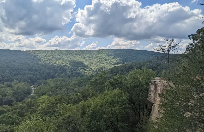
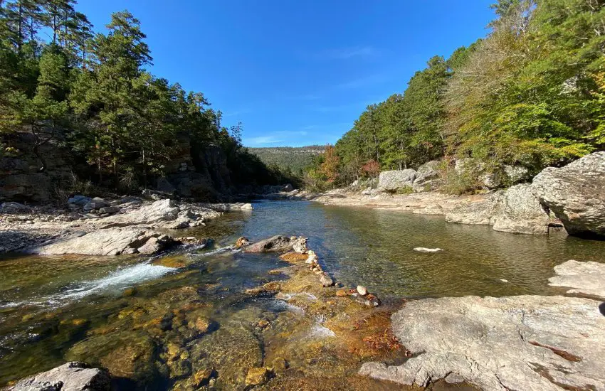
Centerpoint to Goat Trail
Ready to explore one of the most popular trails in Buffalo National River? Head to the Centerpoint to Goat Trail, an out-and-back route considered moderately challenging that covers approximately 5.9 miles.
This trail is a popular spot for backpackers, campers, and fishers, so you might cross paths with other enthusiasts during your adventure. Note that pups had to stay at home – dogs are not allowed on this trail.
The highlight of this trail is the breathtaking view from the Big Bluff overlooking the Buffalo River. Standing at over 500 ft. tall, it’s considered the most elevated along the river. The Goat Trail leading to an outcropping on the bluff is around 350 ft. tall, so bear in mind that it might not be suitable for kids or those who fear altitudes.
While the trail is virtually all downhill on the way to the Bluff and Goat Trail, reserve extra time to hike uphill during the way out. As the trail passes through the Ozark Mountains, get ready to capture some scenic views over the Buffalo River valley. But be careful as there have been fatal accidents on the trail.
Buffalo National River also offers a plethora of connector routes to different hiking trails, providing more options to enjoy the surrounding areas.
- Length: 5.9 miles
- Elevation gain: 1,076 ft
- Difficulty: Moderately challenging
- Pets allowed: No.
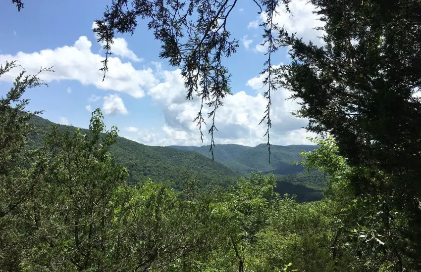
Yellow Rock Trail
The Yellow Rock Trail is a moderately challenging 3.1-mile loop trail located in the Devil’s Den State Park, and is sure to delight hikers across the state. It takes around 1 hour and 27 minutes to traverse and boasts a moderate level of difficulty. Plus, your furry friends are welcome too (just make sure to keep them leashed up)!
Explore a bit of history on this trail, as it’s an original CCC-constructed trail from the 1930s, making it part of the National Trails System. The trailheads include the Highway 70 CCC overlook (upper trailhead with a 100 feet elevation change) and the Camp Area A trailhead (lower trailhead, 300 feet elevation change). This makes it convenient for hikers to choose the starting point they prefer.
The Yellow Rock Trail is popular for a reason, as it offers beautiful views of the Lee Creek Valley from the Yellow Rock Overlook. This is definitely the highlight of the trail and worth the effort. Be aware though; it can get crowded on the weekends. Keep an eye out for the white blazes marking the path as you make your way along the loop.
Get a good workout during your excursion, as the trail has an elevation gain of 551 ft. Although the trail can be a bit challenging, it’s worth it to reach the overlook and take in the stunning views.
- Length: 3.1 miles
- Elevation gain: 551 ft
- Difficulty: Moderate
- Pets allowed: Yes, but must be on a leash.
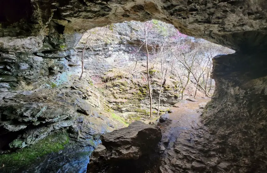
Devil’s Den Trail
Get ready to explore an amazing 1.6-mile loop trail that will leave you speechless. Devil’s Den Trail is a must-visit area located near West Fork, Arkansas. It’s home to an array of natural wonders, including Devil’s Den Cave, Devil’s Ice Box, Twin Falls, Cold Springs, and much more.
This moderately challenging trail is perfect for all experience levels and takes an average of around 40 minutes to complete. Feel free to bring your furry friends along for the journey, but don’t forget to keep them leashed.
One of the main features of the Devil’s Den Trail is that it’s a part of the National Trails System and was constructed by the Civilian Conservation Corps in the 1930s. This trail is well-known for birding, hiking, and its unique natural landscape. Keep your eyes peeled for the trail’s white blazes as you make your way through the loop.
While trekking along the trail, you’ll be surrounded by stunning views of the park’s rugged terrain. The Devil’s Den Trail’s natural features offer insight into the constant geological forces shaping the park’s landscapes. The caves are closed to protect bats and their habitat from White-Nose Syndrome, but there’s still plenty to explore.
The trail’s elevation gain is 209 ft, so make sure to wear comfortable shoes and bring plenty of water. The park is open year-round, allowing visitors to experience its natural beauty anytime.
- Length: 1.6 miles
- Elevation Gain: 209 ft
- Difficulty: Moderate
- Pets: Yes, but must be on a leash
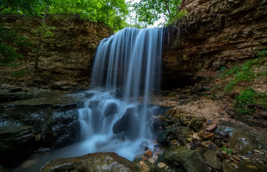
Cedar Falls Trail
Cedar Falls Trail at Petit Jean State Park is a place where natural beauty thrives. It’s the ideal spot to bust out your camera and snap some Instagram-worthy photos. With a moderately challenging 1.9-mile out-and-back trail, it’s worth the average of 56 minutes to complete.
Once you make it up, get ready for the highlight of the trail – the Cedar Falls. The moment it comes into view, you’ll be awestruck. It’s no wonder why so many photographers have captured its beauty. Cedar Falls has a consistent flow of water and makes a 95-ft waterfall that cascades down into a large pool (just remember swimming is illegal there). The trail starts at Mather Lodge and ends at Cedar Falls, and it’s worth every step.
Be prepared for the overall elevation gain of 367 ft, so make sure to wear comfortable shoes and bring lots of water. When you’re ready to head back, retrace your steps up the canyon side.
- Length: 1.9 mi
- Elevation gain: 367 ft
- Difficulty: Moderate
- Pets: Yes, but must be on a leash.
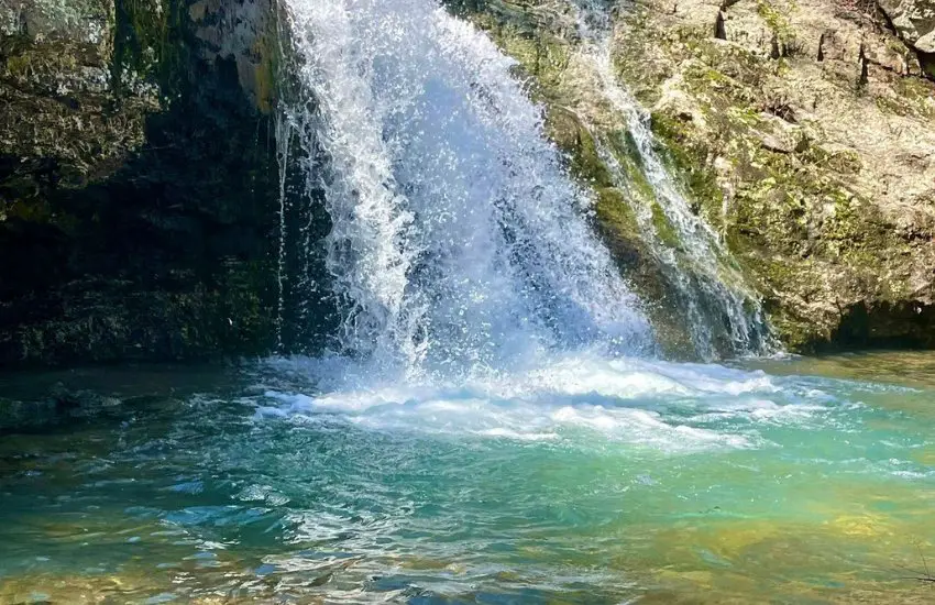
Glory Hole Waterfall Trail
Are you ready for an adventure through lush forests and mountain trails? Look no further than the Glory Hole Waterfall Trail in the Ozark National Forest. This 1.9-mile out-and-back trail is considered moderately challenging, but it’s worth every step to see the stunning Glory Hole waterfall.
Located near Deer, Arkansas, this trail takes an average of 59 minutes to complete and is open year-round. Don’t be surprised if you have company along the way – this popular hike is a local favorite. Bring your furry friends for extra company, but keep them leashed as a precaution.
The trail is accessible from the side of the road on Highway 16, just a few miles south of Edwards Junction. As you make your way down the old jeep trail-turned-narrow path, the beauty of the Ozark National Forest surrounds you. The trail descends into a valley, where you’ll find the Glory Hole waterfall with its unique round hole formation.
You’ll want to plan your visit accordingly since the water flow is best in the spring or after a good rain. When approaching the waterfall from the top, be sure to use caution and closely follow the path.
- Length: 1.9 miles
- Elevation gain: 410 ft
- Difficulty: Moderate
- Pets: Allowed on leash
Hemmed In Hollow Trail
Calling all thrill-seekers! If you’re seeking a challenging and rewarding trail, look no further than the Hemmed In Hollow Trail in the Buffalo National River. This 5.7-mile out-and-back trail near Compton, Arkansas is where you can find the tallest waterfall in middle America.
Considered a pretty difficult hike, the Hemmed In Hollow Trail provides a workout that’s well worth the effort. The trail takes an average of 3 hours and 7 minutes to complete and is open year-round. Expect to cross paths with other hikers along the way, as it’s a popular area for exploring. Please note that furry friends will need to stay at home, as dogs are not allowed on this trail.
You can find the trailhead off Erbie Road, just off Highway 43 south of Compton, AR. The mostly well-signed track traverses the Buffalo National River Wilderness Area, leading you to the towering Hemmed In Hollow Falls. Keep a close eye on the trail as it cuts back down towards the falls. It’s easy to miss the red flagging tape marking the departure to the falls. Another side trail follows the creek down to the Buffalo River.
As you make your ascent towards the falls, be prepared for a workout. The hike’s steep elevation changes will work your knees, but the stunning scenery will make it all worthwhile. Make sure to bring plenty of water for the hike. The return trip to the parking lot is just as tough!
- Length: 5.7 miles
- Elevation gain: 1414 ft
- Difficulty: Hard
- Pets: Not allowed
Pinnacle Mountain West Summit Trail
Let me tell you about the Pinnacle Mountain West Summit Trail, a true adventure for any hiker visiting the Little Rock area! This 1.5-mile out-and-back trail is no easy feat, but the stunning sights make it all worth it. You will definitely run into other hikers, so be prepared to make new friends along the way. This is a popular area year-round, so plan accordingly. The best part? You can bring your furry friend on this one, but keep them on a leash.
Starting at the park picnic grounds, prepare yourself for a rocky terrain that will lead you to the summit of Pinnacle Mountain. The views along the way are breathtaking, but they don’t compare to the top. Take in the scenery while overlooking Lake Maumelle, the Arkansas River Valley, the Ouachita Mountains, and West Little Rock. You won’t forget this view anytime soon!
Trekking back down the trail will bring you back to where you started, but for a little bit more adventure, try out the rugged East Summit Trail, adding an extra mile to your hike. Be sure to follow the base trail on the way back, and enjoy a full hike of 2 1/2 miles.
- Length: 1.5 miles
- Elevation gain: 728 ft
- Difficulty: Moderate
- Pets: Allowed on a leash
Falls Branch Trail
Looking for a moderately challenging hike with a scenic waterfall? Look no further than Falls Branch Trail in Lake Catherine State Park! This 1.7-mile loop trail winds through the pine and hardwood forest of the park and crosses Little Canyon Creek multiple times. You’ll get to see the seasonal scenic waterfall at Falls Creek, which is sure to be a highlight of your trip.
Families love this popular trail, and it’s easy to see why. The Falls are mesmerizing, and the hike is enjoyable and not too difficult. You also have the option to go counter-clockwise or in the other direction, whichever works best for you.
Don’t forget to bring your furry friend along for the adventure. Dogs are welcome, as long as they’re on a leash.
If you want an adventure that fits into a busy schedule, this hike is perfect. It takes an average of 42 min to complete, and it’s well worth the time.
- Length: 1.7 miles
- Elevation Gain: 209 feet
- Difficulty: Moderate
- Pets: Dogs are welcome, as long as they’re on a leash
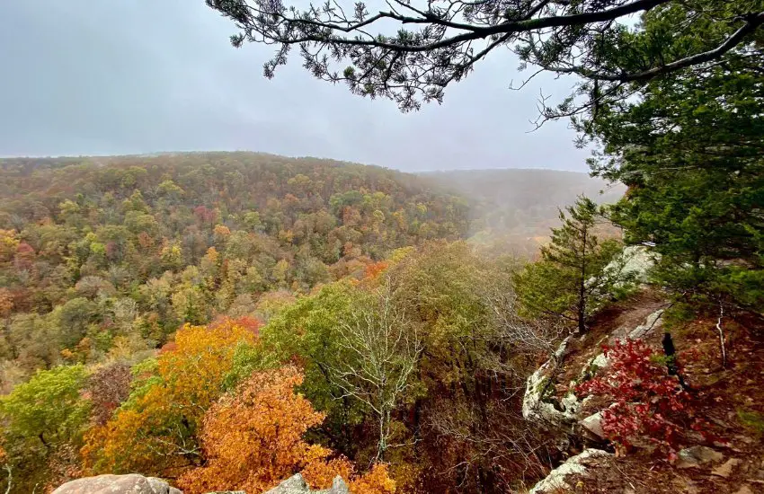
Eagle Rock Loop
Ready for a true test of your hiking skills? Look no further than the Eagle Rock Loop, a 26.5-mile loop trail that takes you through the stunning Ouachita National Forest in Arkansas. Although this route is known for its difficulty, it is also incredibly rewarding, with breathtaking scenery around every corner.
Starting at the Winding Stairs Trailhead, you can choose to tackle the loop clockwise or counterclockwise. Whichever way you choose, you’re in for a treat. The trail is known for its lush vegetation, rivers, waterfalls, and rocky ridges. And with ample camping sites and water sources available along the way, you can take your time and fully immerse yourself in the beauty of the wilderness.
As with any hike, it’s important to be prepared for the trail conditions. There are multiple creek crossings with varying degrees of depth, so make sure you know your limits and wear appropriate footwear. And even though the loop is open year-round, be aware that weather conditions can change quickly in the area.
One thing is for sure – you won’t be alone on this trail. The Eagle Rock Loop is very popular among backpackers, campers, and hikers, so you’re bound to cross paths with other adventurers along the way.
If you’re up for the challenge and want to see some of the most beautiful scenery in Arkansas, the Eagle Rock Loop is calling your name. Just don’t forget to download a map ahead of time, as phone reception is sparse along the trail.
- Length: 26.5 miles
- Elevation gain: 4000 ft
- Difficulty: Hard
- Pets: Allowed on a leash
Frequently Asked Questions About Hiking in Arkansas
What gear do I need to hike in Arkansas?
At minimum, you’ll need comfortable walking shoes with good grip, a backpack for carrying water and snacks, and breathable clothing appropriate for the weather conditions. If you’re planning on hiking overnight, make sure to bring a tent and sleeping bag as well.
Are there any poisonous animals or plants to look out for?
Yes, there are a few venomous snakes in Arkansas, including copperheads, cottonmouths, and several types of rattlesnakes. However, they are rarely seen and usually avoid humans. Poison ivy and poison oak also grow in the area, so it’s important to learn how to identify them and avoid contact.
Can I bring my dog on hiking trails in Arkansas?
Yes, dogs are allowed on most hiking trails in Arkansas, but they must be on a leash at all times. Be sure to bring water and food for your pet, and follow leave-no-trace principles by packing out any waste. All trails listed in the article mention whether dogs are allowed or not.
Are hiking trails in Arkansas open year-round?
Most hiking trails in Arkansas are open year-round (barring park closures), but weather conditions can vary greatly depending on the season. Summers are hot and humid, while winters can be cold and snowy. Make sure to check the forecast before hitting the trail, and prepare accordingly.
Are there any hiking trails in Arkansas that are suitable for beginners?
Absolutely! Arkansas has plenty of easy hiking trails that are perfect for beginners or families with children. A few great options include Petit Jean State Park, Pinnacle Mountain State Park, and Hobbs State Park-Conservation Area. Be sure to check the trail length and difficulty level before you go.